Device and geofences
The Dispositivo (device) tab shows the status of the tracker installed in the vehicle. From here you also open the geofence maps. The content depends on the tracker: vehicles connected through the CAN bus show more data.
Tracker page
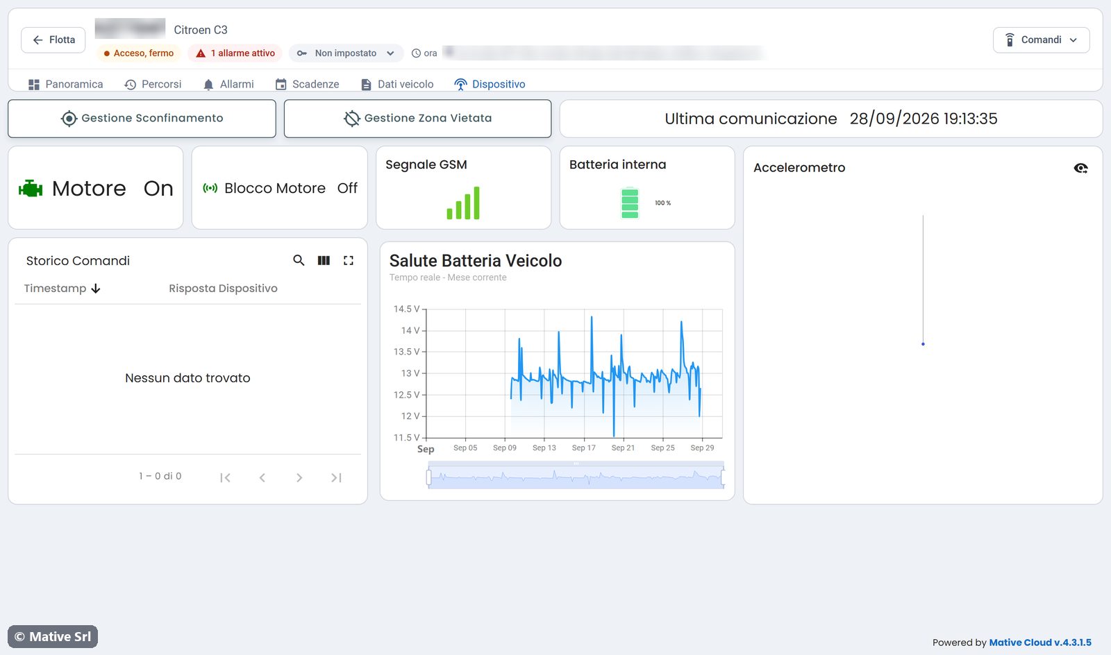
| Widget | Content |
|---|---|
| Gestione Sconfinamento | Opens the map of the allowed area |
| Gestione Zona Vietata | Opens the map of the forbidden zone |
| Ultima comunicazione | Date and time of the last data received |
| Motore | Engine on or off |
| Blocco Motore | Engine lock active or not |
| Segnale GSM | Mobile signal strength |
| Batteria interna | Charge of the tracker's internal battery |
| Accelerometro | Accelerometer values on the three axes |
| Storico Comandi | Commands sent and the tracker's replies |
| Salute Batteria Veicolo | Vehicle battery voltage in the current month |
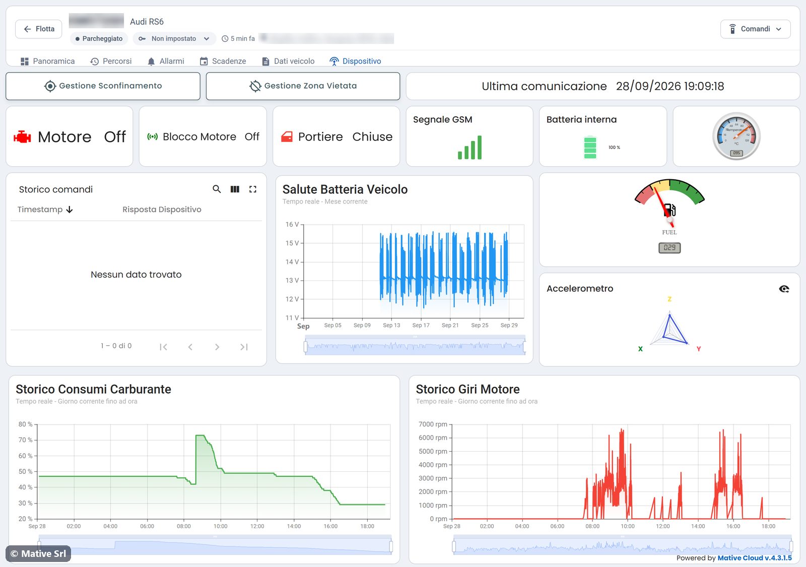
Vehicles connected through the CAN bus
When the tracker reads the CAN bus, the page also shows door status (Portiere), engine temperature, fuel level, fuel consumption history (Storico Consumi Carburante) and engine speed history (Storico Giri Motore).
Allowed area
Gestione Sconfinamento opens the map of the area where the vehicle is allowed to be. When the vehicle leaves it, the platform generates the Sconfinamento Veicolo alarm.
Forbidden zone
Gestione Zona Vietata opens the map of the zone the vehicle must not enter. When the vehicle enters it, the platform generates the Veicolo entrato in area non autorizzata alarm.
On both maps, the tools on the left edge draw and edit the area.