Reports: route history and vehicle list
The Report page has two tools:
- Storico percorsi (route history): trips, alarms and positions of one vehicle in a period of up to 31 days, with a map, a PDF and a CSV file. It is designed also for requests from the police and other authorities.
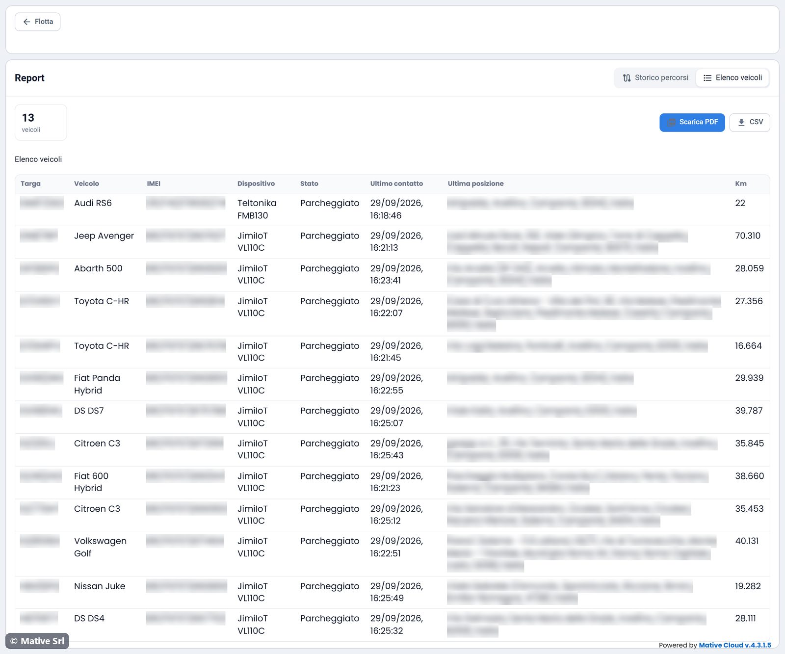
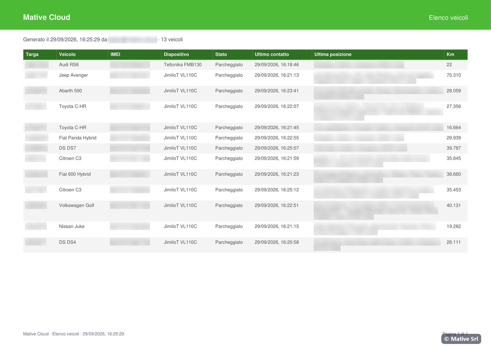
- Elenco veicoli (vehicle list): all the vehicles of the fleet with their device and last position, in PDF and CSV.
Open it with the Report button on the fleet home. In Drive it is the Report tab of the vehicle.
Route history
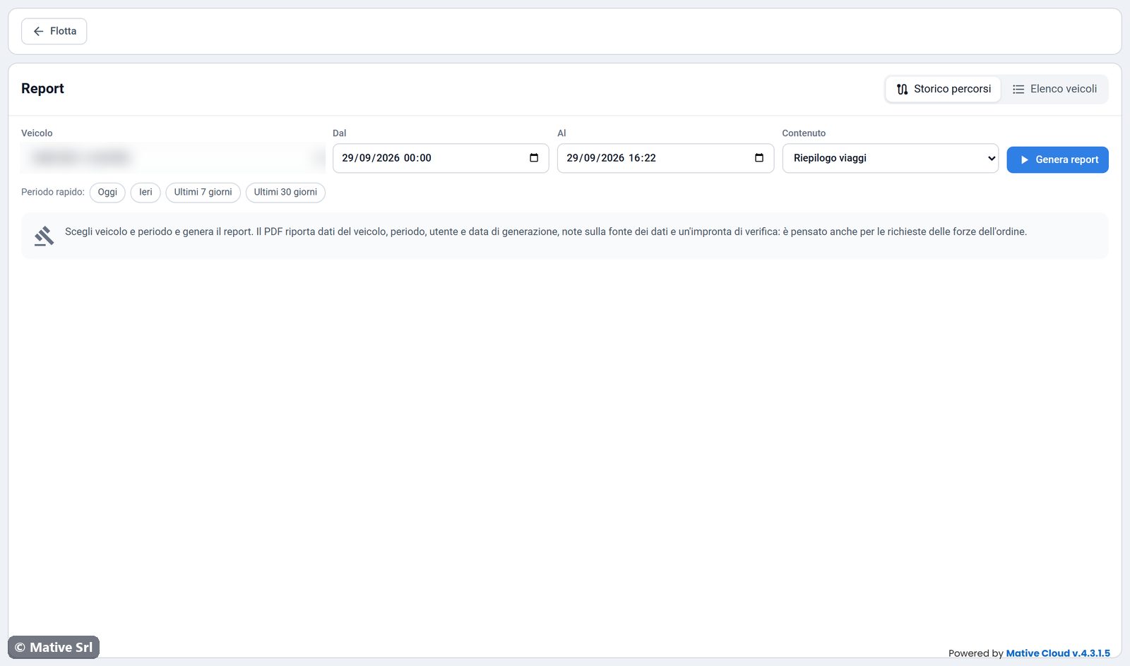
- Choose the Veicolo (vehicle).
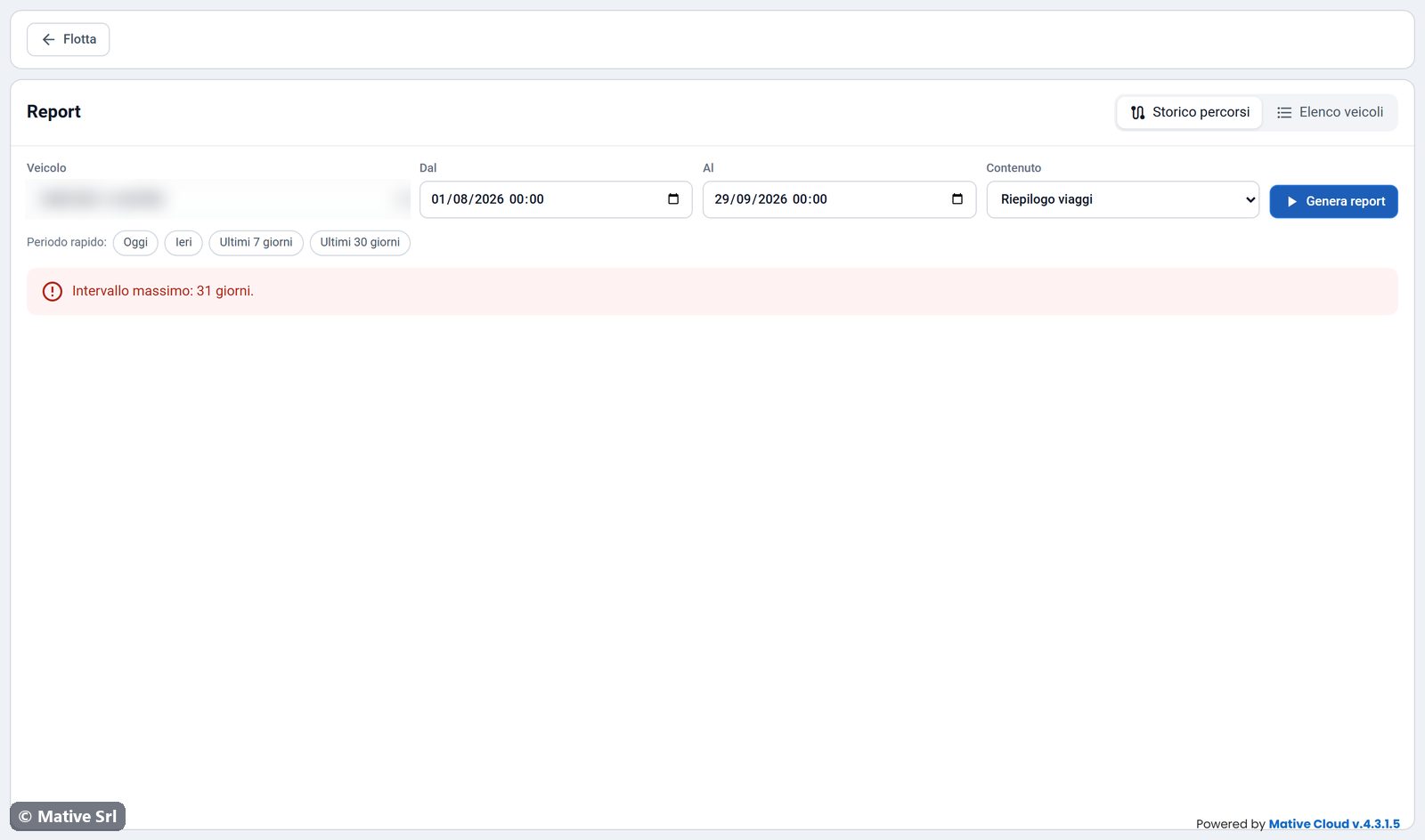
- Set Dal (from) and Al (to), or use Periodo rapido (quick period): Oggi (today), Ieri (yesterday), Ultimi 7 giorni, Ultimi 30 giorni.
- Choose the Contenuto (content):
- Riepilogo viaggi (trip summary): summary, map, trips and alarms;
- Viaggi e tutte le posizioni (trips and all positions): the same, plus every position sent by the device.
- Click Genera report (generate report).
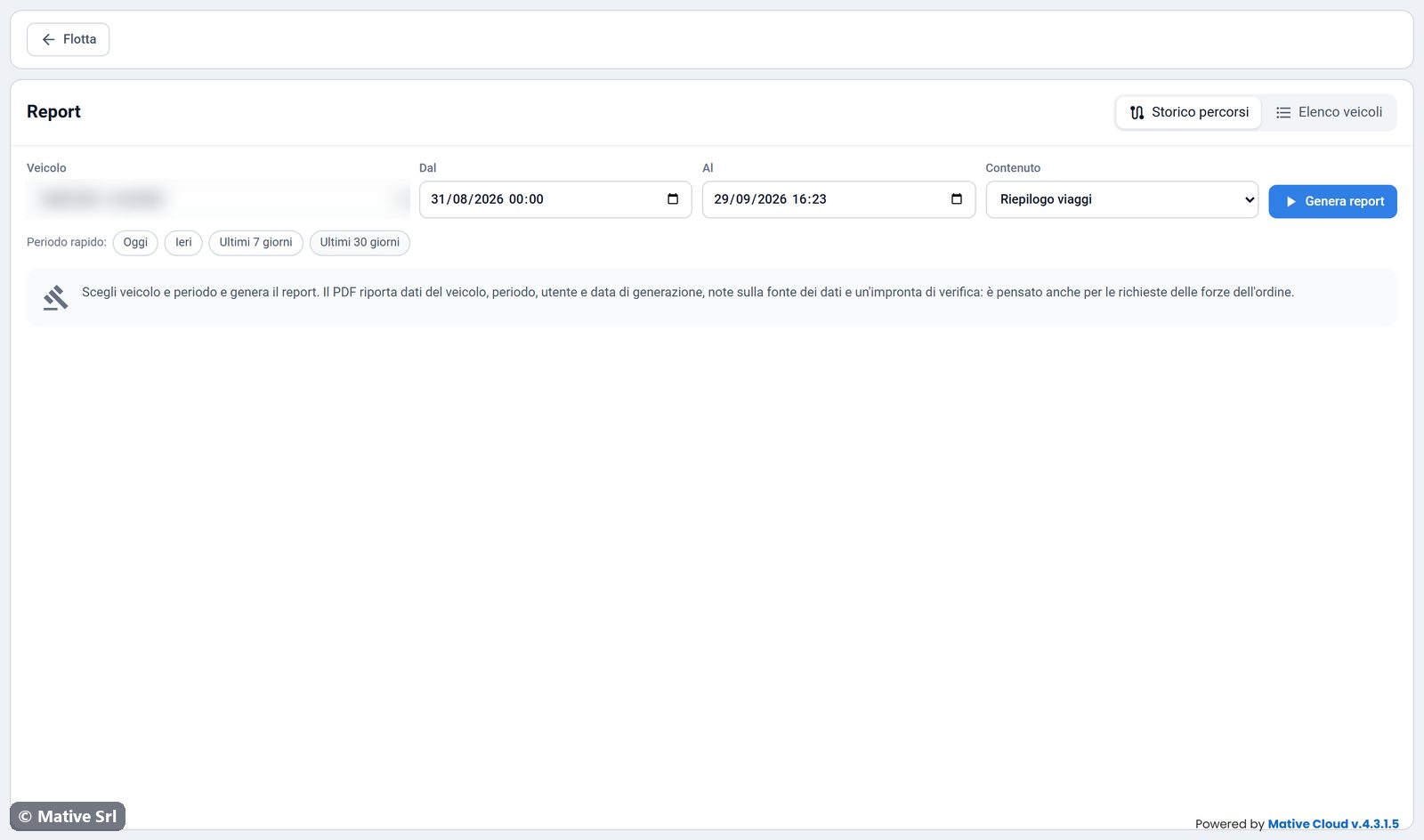
A report over 30 days can take 5 to 15 seconds.
Limits
- The period can be at most 31 days. A longer interval shows the message Intervallo massimo: 31 giorni. (maximum interval: 31 days).
- You can go back only as far as the history kept by the platform under your service contract.
Preview
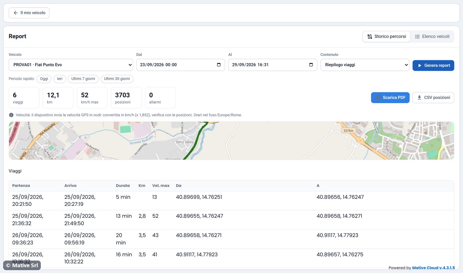
The report first appears in the page:
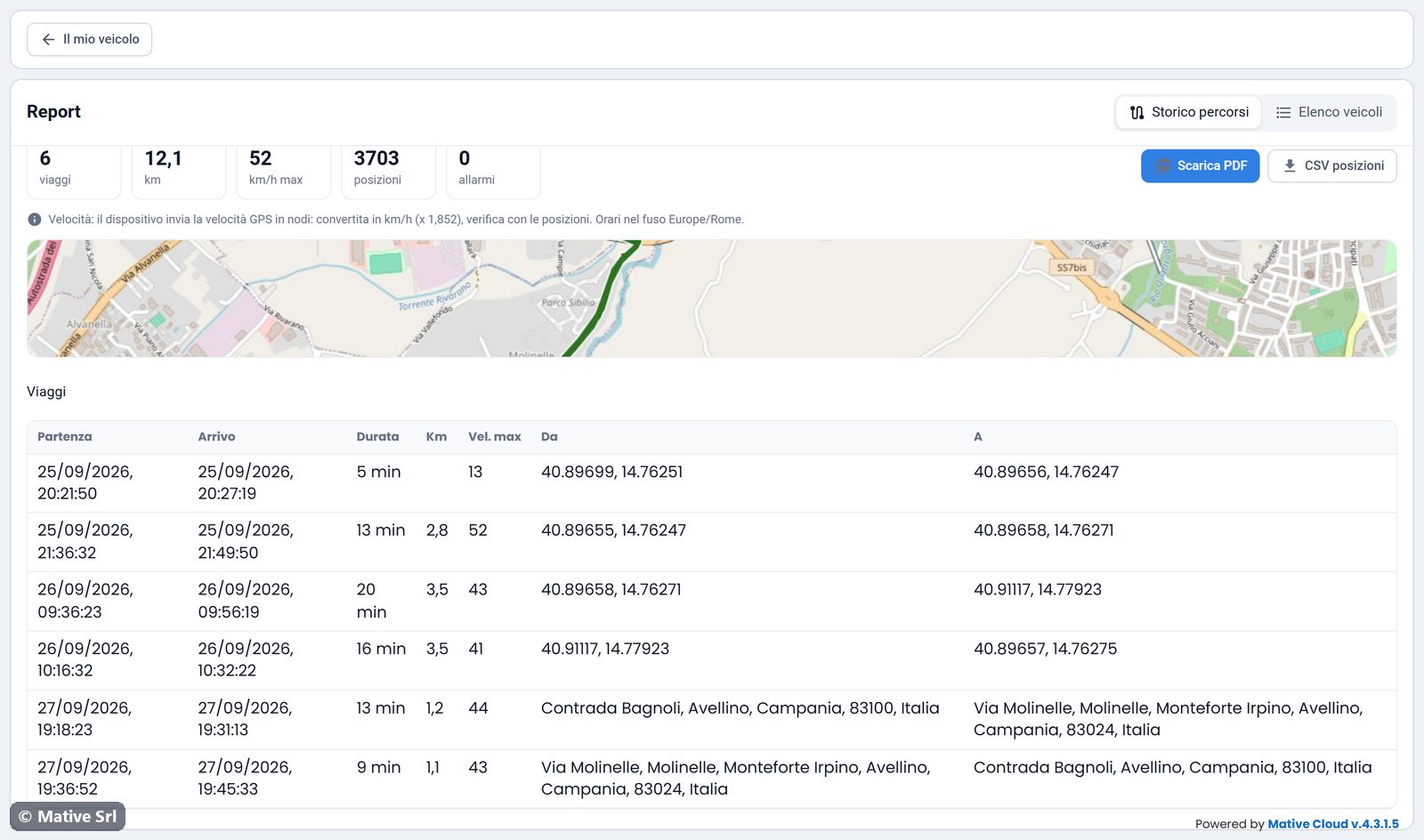
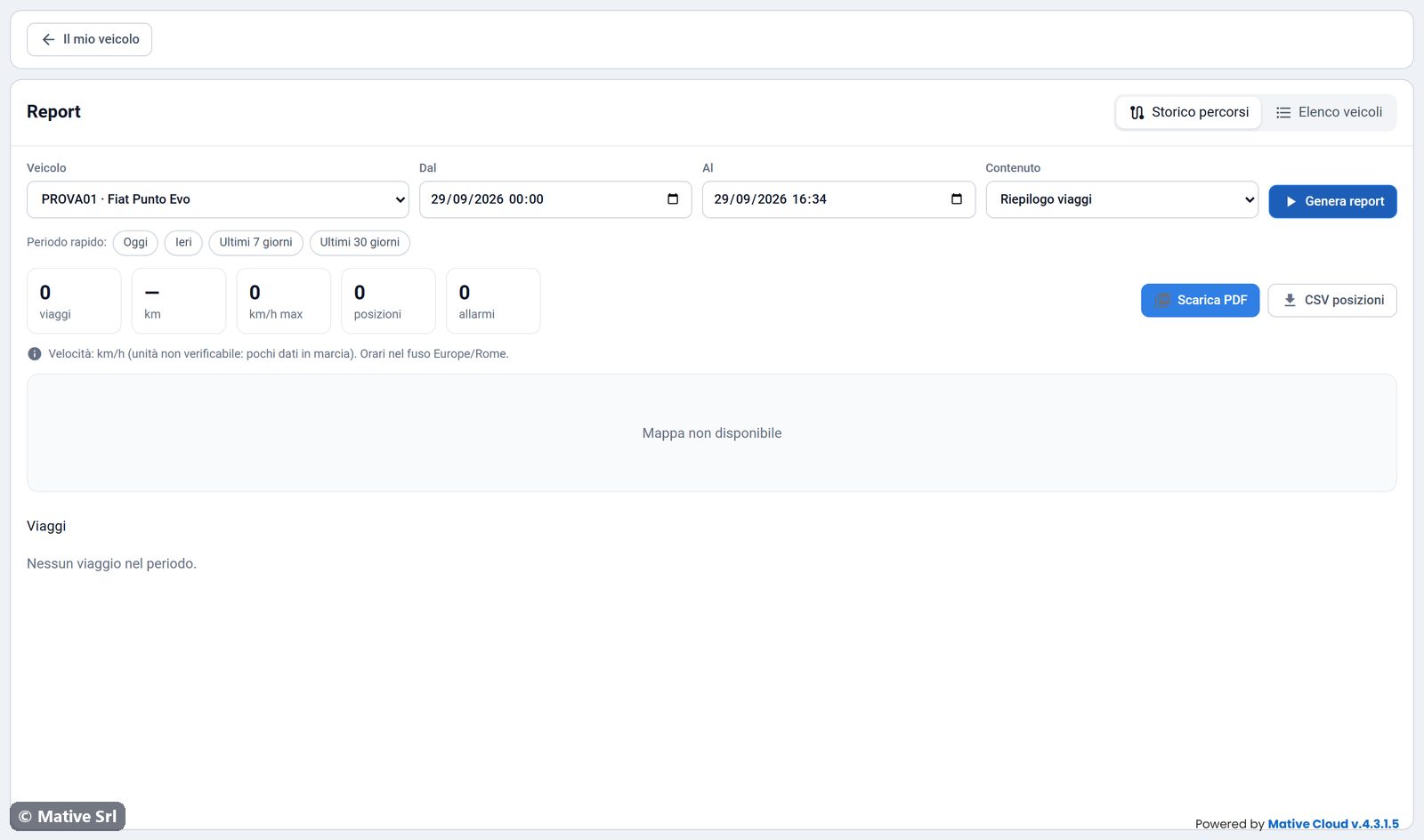
- summary: trips, km, maximum speed, number of positions and alarms;
- Scarica PDF (download PDF) and CSV posizioni (positions CSV);
- a note on how the speed was obtained and on the time zone;
- the map of the route;
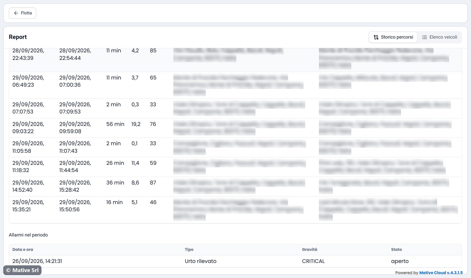
- the Viaggi (trips) table: departure, arrival, duration, km, maximum speed, from, to;
- the Allarmi nel periodo (alarms in the period) table: date and time, type, severity, status.
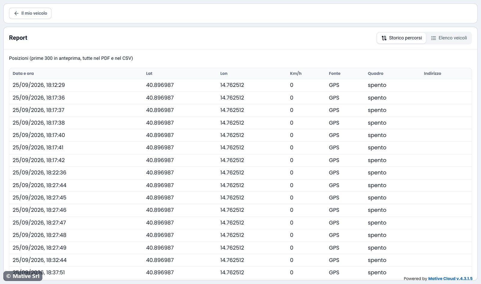
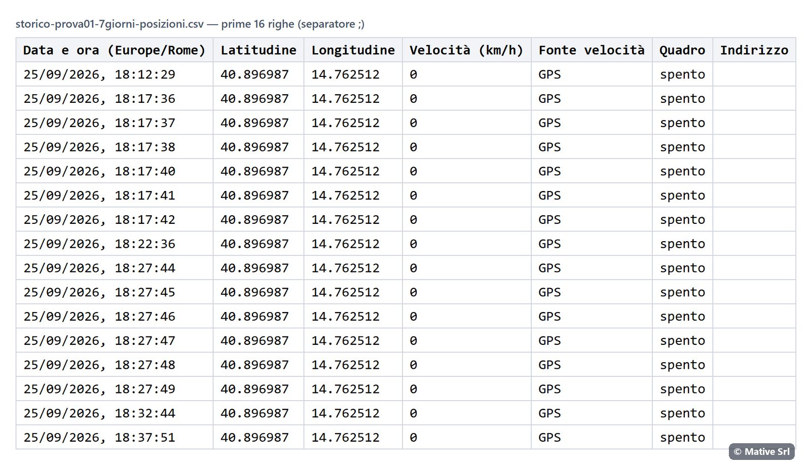
With Viaggi e tutte le posizioni, the Posizioni table lists date and time, latitude, longitude, speed, speed source (GPS or CAN), ignition and address. The page shows the first 300 positions; the PDF and the CSV contain all of them.
If the vehicle did not move in the period, the report says Nessun viaggio nel periodo. (no trips in the period).
How the data is obtained
- Positions and times are the raw data sent by the device.
- Speed in km/h, addresses and trips are processed data, calculated from the raw data:
- trips are rebuilt from the ignition status; switch-offs shorter than 5 minutes belong to the same trip;
- the speed is the one read from the vehicle's control unit (CAN) when available, otherwise the GPS speed, converted to km/h when the device sends it in knots;
- km come from the odometer;
- addresses come from the geocoding of the coordinates and are indicative.
- Times are in the Europe/Rome time zone.
PDF
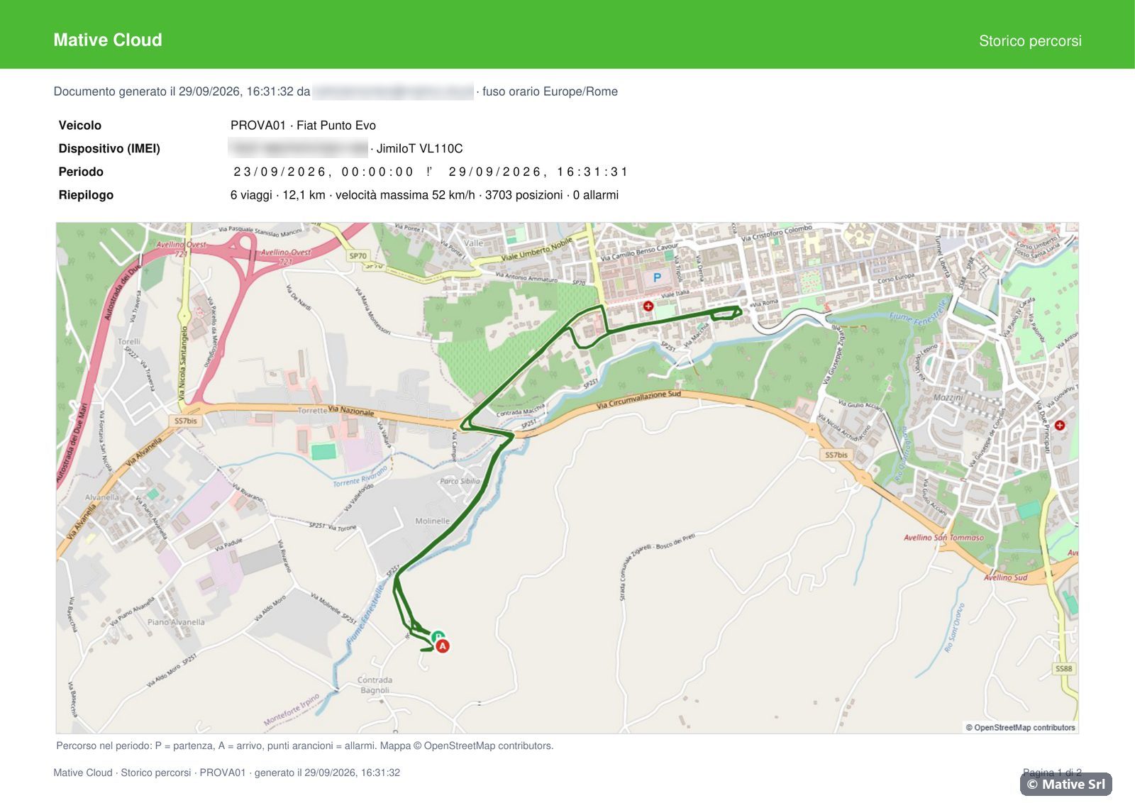
Scarica PDF prepares the document (Preparazione del PDF…) and downloads it. It is an A4 landscape document with:
- the header, with the user who generated it and the date;
- the vehicle, the IMEI and the model of the device, the period and the summary;
- the map of the route on the first page: P is the departure, A the arrival, orange points are the alarms. Map © OpenStreetMap contributors. If the map cannot be loaded, the report is produced without it;
- the trips, the alarms and, if chosen, all the positions;
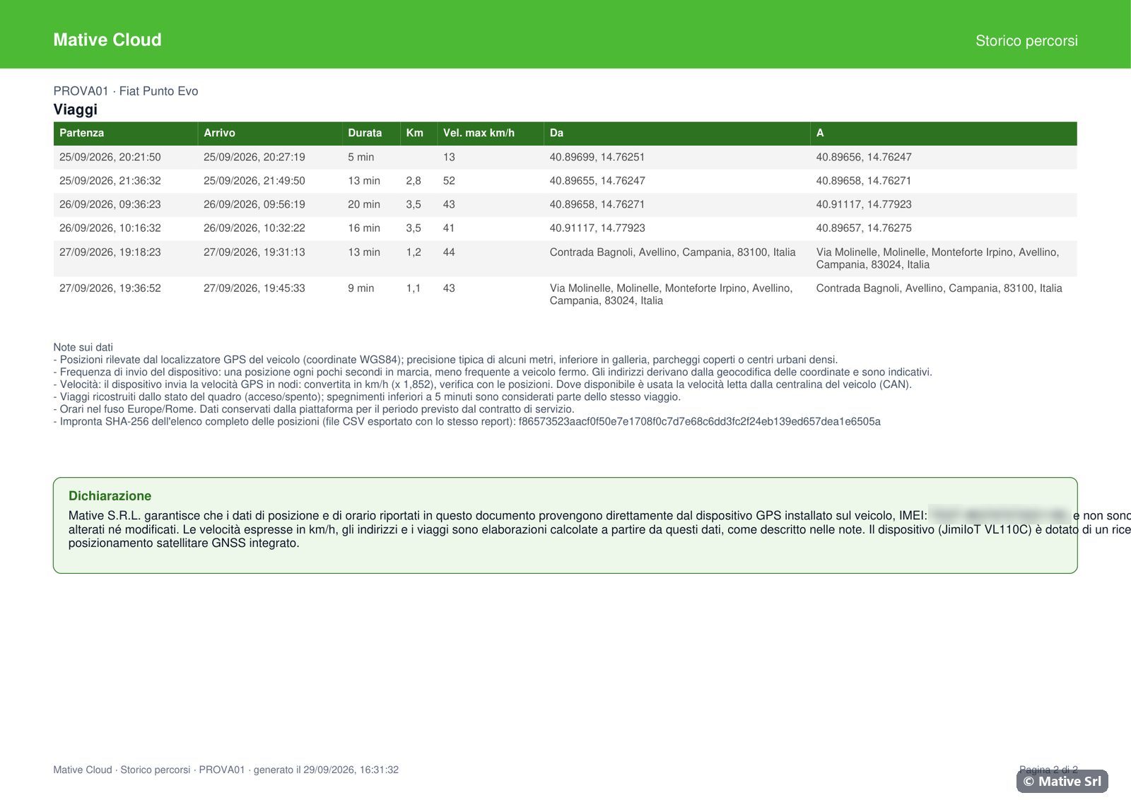
- the Note sui dati (notes on the data) and the SHA-256 fingerprint of the CSV file of the positions;
- the Dichiarazione (declaration) on the last page;
- page numbers "Pagina n di m".
Declaration
The last page contains the declaration by Mative S.R.L. that the position and time data in the document come directly from the GPS device installed on the vehicle, identified by its IMEI, and have not been altered or modified. The declaration states that speeds in km/h, addresses and trips are processed data, calculated from those raw data as described in the notes.
The declaration names the satellite systems only when they are verified for the device model:
| Device | Text in the declaration |
|---|---|
| Teltonika FMB, FMC, FMT | multi-constellation GNSS receiver (GPS, GLONASS, Galileo and BeiDou) |
| JimiIoT X3 | GPS and BeiDou (BDS) satellite positioning systems |
| Other models, JimiIoT VL110C included | integrated GNSS satellite positioning receiver |
SHA-256 fingerprint
The notes contain the SHA-256 fingerprint of the positions CSV exported with the same report. Whoever receives the PDF and the CSV can compute the SHA-256 of the CSV file (for example with sha256sum on Linux and macOS, or certutil -hashfile file.csv SHA256 on Windows): if it matches the value in the PDF, the CSV has not been altered after it was exported.
CSV
CSV posizioni downloads a CSV file with all the positions of the period, separated by semicolons: date and time, latitude, longitude, speed in km/h, speed source, ignition, address.
Where the files are created
PDF and CSV are created in your browser and downloaded to your computer or phone. They are not kept on the server.
Vehicle list
Elenco veicoli lists all the vehicles with plate, vehicle, IMEI, device, status, last contact, last position and km. Scarica PDF and CSV export the list.